Ardross Castle & Elie House
 Ardross Castle, Elie (© Martin Coventry)
Ardross Castle is a much reduced ruin in a pretty spot above a beach, long associated with the Dishington family, then the Scotts and Anstruthers, while Elie House replaced the castle, to the east of Elie in the East Neuk of Fife in central Scotland.
Elie, Fife KY9 1EU NO 508007 OS: 59 Ruin 364
Ardross Castle: access at all reasonable times, on coastal path between Elie and St Monans.
Well-stocked popular farm shop at Ardross.
Elie House: private.
Elie Castle: private
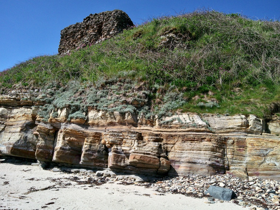
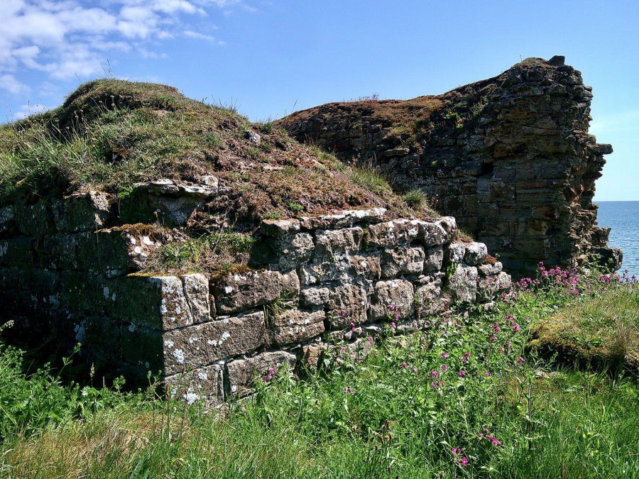
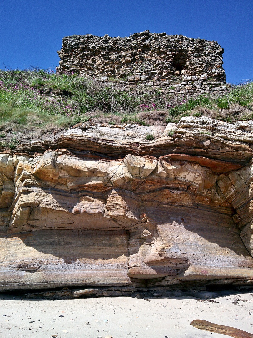
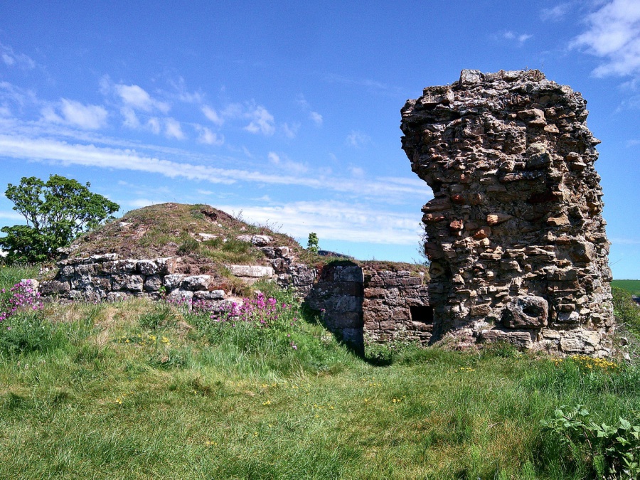
Ardross Castle
 Ardross Castle, Elie (© Martin Coventry)
Little remains of an altered 14th- or 15th-century castle on a cliff above the sea, except the basement of a tower, which was vaulted, and the ruins of a later block, both with walls up to six-feet thick. The castle was quite ruinous by 1850 or earlier, and appears to have been replaced by what is now called Elie House.
 Ardross Castle: doocot (© Martin Coventry)
A rectangular lectern doocot [NT 507007] dates from the 17th century by the road (A917) near the farm.
 Ardross Castle (© Martin Coventry)
The lands of Ardross also included Elie, and eventually the whole property became known as Elie.
‘Ardross’ is marked on Blaeu (1654), then on Adair’s map of East Fife (1684) when shown in rectangular enclosed grounds with gardens and trees (presumably now Elie House and see below) to the north-west of ‘Ardross C[astle]’ marked on the coast. ‘Ardross’ is marked on Ainslie’s map of Fife (1775) while a house is depicted north-east of Elie with ‘Sir John Anstruther’, again Elie House. The OSNB notes for Ardross Castle, ‘All that now remains of this ancient castle is the outside wall, which is about five feet in thickness and about seven-feet high.’
 Ardross Castle (© Martin Coventry)
Ardross Castle was held by the Dishington family, one of whom, Sir William Dishington, was Sheriff of Fife in the 14th century, and was responsible for the building of the impressive St Monans Old Kirk [NO 523014] (see Newark Castle, St Monans). John Dishington of Ardross was probably killed at the Battle of Flodden in 1513, while William Dishington of Ardross was slain at the Battle of Pinkie in 1547. Thomas Dishington of Ardross is mentioned in 1589.
 Ardross Castle (© Martin Coventry)
Ardross was sold to Sir William Scott in 1607, and Sir William Scott of Ardross is on record in 1645, then John Scott of Ardross in 1680. The property passed to Sir William Anstruther of that ilk towards the end of the 17th century, then later to the Bairds of Elie, who held this property in the mid 19th, but was sold to the Nairns in 1928, who are still in possession.
 Ardross Castle (© Martin Coventry)
The ruin of Ardross Castle is accessible at all times, located by the coastal path, and stands above a fine sandy beach.
Elie House
Elie, Fife KY9 1ER NO 495008 OS: 59 Private 1979
Standing in seven acres of landscaped grounds, Elie House is an extensive three-storey and a basement and attic classical mansion with other ranges, but incorporates an L-plan house dating from about 1697, itself built on the foundations of an earlier castle.
 Elie House (Macgeorge, 1875)
There is a small round doocot [NO 493008], dating from the late 18th century, and a walled garden.
‘Ely C.’ is marked on Blaeu (1654) and this appears to be this site rather than Elie Castle in the village of Elie. Only the village appears to be marked on Adair’s map of East Fife (1684) while ‘Ardross’ is marked in enclosed grounds (presumable now Elie House, and also see Ardross Castle), while a house is depicted in extensive wooded parkland to the north-east of the village on Ainslie (1775). The OSNB notes, ‘A large and well-built mansion house with offices, all of which are only in indifferent repair. The mansion house was built at two different periods, the last part about 100 years ago, the east end is much older … it is not occupied at present, or has not been for the last 20 years. Attached to it is a small but well-enclosed garden and a large tract of arable and ornamental wooded demesne land.’
The original castle was built by Sir Andrew Anstruther in 1366, although by the 17th century the property had passed to the Scotts. William Scott of Ardross and Elie is on record at the beginning of the 17th century, and this property was also formerly known as Ardross, while Sir John Anstruther was the proprietor in 1775.
Elie House was altered and extended about 1740, and in the 19th century, by when title had passed to the Bairds. The estate was sold to the Nairns in 1928, the house was altered again in the 20th century while being used as a convent of nuns.
Between 2006 and 2010 the house and orangery was refurbished and divided into apartments.
The estate (which includes Ardross) of 1,500 acres stayed with the Nairns, and is owned and managed by the trustees of the Elie Estate Trust under the stewardship of Sir Michael Nairn, baronet, and his son, Alex.
The obelisk monument [NO 496004], some 60-feet high, was erected by the Anstruthers and has their coat of arms. It is said to commemorate the Union of Parliaments of Scotland and England in 1707.
In a prominent pretty spot, Lady's Tower [NT 500994] on Elie Ness is the ruin of a building of 1770, said to have been built for Lady Janet Anstruther to change when she was bathing and swimming in the sea. It was a ruin by the middle of the 19th century.
Elie and nearby Earlsferry are attractive villages with good beaches, though the authors of The Castellated and Domestic Architecture of Scotland complained about Elie: 'the hand of the philistine has been laid heavily on them, and Elie has no become a commonplace modern seaside resort, with whatever of architectural or historical interest it ever had almost crushed out of it.’ The Castle or Elie Castle survives (see below).
The Castle, Elie | Elie Castle
Elie, Fife KY9 1BL NO 491000 OS: 59 Private 458
Overlooking the beach on South Street, Elie Castle is a 17th-century L-plan tower house of three storeys and a garret, although it incorporates work from the 15th or 16th century. It consists of a long main block and a projecting rectangular stair-tower, rising a storey higher, and crowned by a corbelled- out square caphouse. The gables are corbiestepped, the walls are harled and yellow washed, and the basement is vaulted.
Some original painting and panelling survives.
Elie Castle (above), later called Ardross, then Elie House is described above.
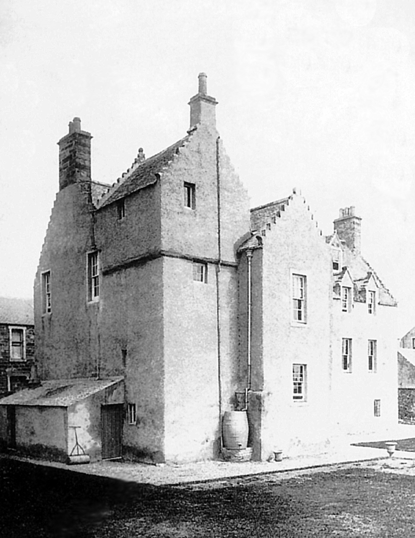 The Castle, Elie or Elie Castle, South Street (old postcard)
‘Ely C.’ is marked on Blaeu (1654) though this is what is now Elie House, but only the village on Adair's map of East Fife (1684) with ‘Ardross’ at Elie House, while the village is on Ainslie (1775). The OSNB notes for the village, ‘A village, being a burgh of barony … the houses are one- and two-storeys high, in good repair, and are chiefly occupied by fishermen.’
The tower house was occupied by Dr John Gourlay, second son of Sir John Gourlay of Kincraig, in 1658, but later passed to the Arthurs, then to the Scott-Moncreiffes. It is still occupied.
The parish church [NO 492001] is a T-shaped building with the tower crowned by a belfry in the centre. The church dates from 1639, though it was ruinous in 1670, but was extended in 1726 and repaired in 1831. There are old memorials in the graveyard, dating from the 16th century.

 The Castles of Scotland New Sixth Edition by Martin Coventry
New sixth edition.
The book is now available.
 Viridian: a vivid blend of book and website

Check any and all opening and access information with the sites themselves…


Contact Us


Goblinshead
Cockenzie House
22 Edinburgh Road
Cockenzie
EH32 0HY
Email: info@thecastlesofscotland.co.uk
Or use our contact form.