Seton Castle
Lothians: About 1.5 miles north-east of Tranent, on minor road north of A198, 0.5 miles south-east of Cockenzie and Port Seton, just east of Seton, at Seton Castle.
Private NT 418751 OS: 66 EH32 0PG
Web: www.setoncastle.com
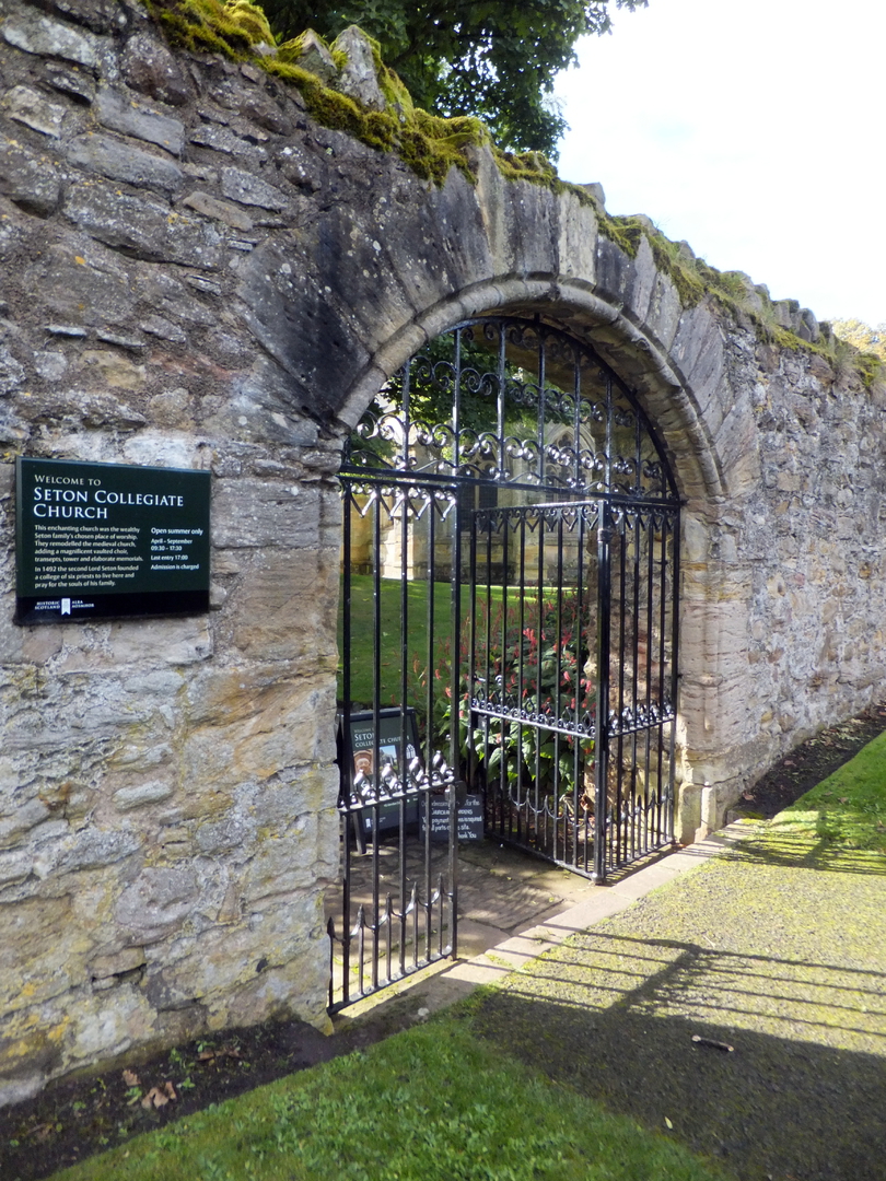
Seton Collegiate Church (HES): open Apr-Sep 9.30-17.30, last entry 17.00. Venue for weddings.
Tel: 01875 813334 Web: www.historicenvironment.scot
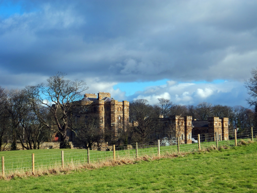 Seton Castle (© Martin Coventry)
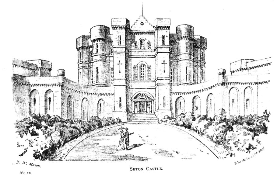 Seton Castle (M'Neill, 1884)
Site of castle, which was apparently a splendid palace after being rebuilt in the 16th century. ‘Seatoun’ is prominently marked on Blaeu’s map of The Lothians, as well as on Adair’s map of East Lothian, where it is depicted in a large walled enclosure with a formal garden, orchard and woodland. The family and place is also often spelt ‘Seaton’.
Images of Seton Palace, c1639-1789
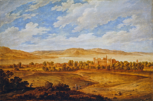
 Seton Palace and the Forth Estuary (1639?) by Alexander Keirincx (1600-1652), Photographer: Antonia Reeve, source: National Gallery of Scotland
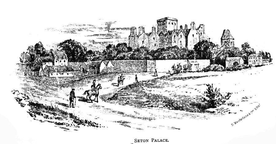
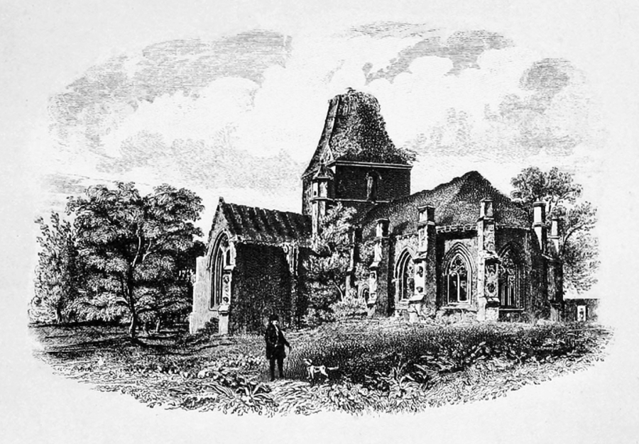
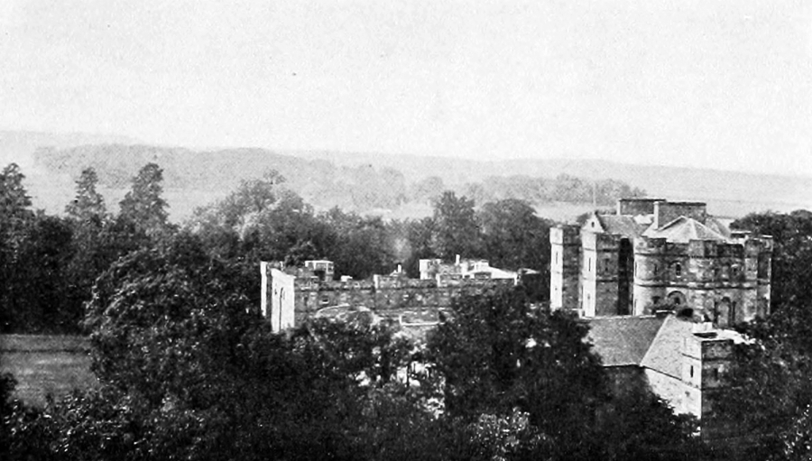
 Seton Castle: Seton Palace, the origin of the image is not clear (M'Neill, 1884)
Note: The top image is apparently the only view of the palace (painted around 1639) before the Jacobite Rising of 1715 and the ruination of the building. It was commissioned to commemorate the visit of Charles I to Scotland in 1633 and is on display in the National Gallery of Scotland.
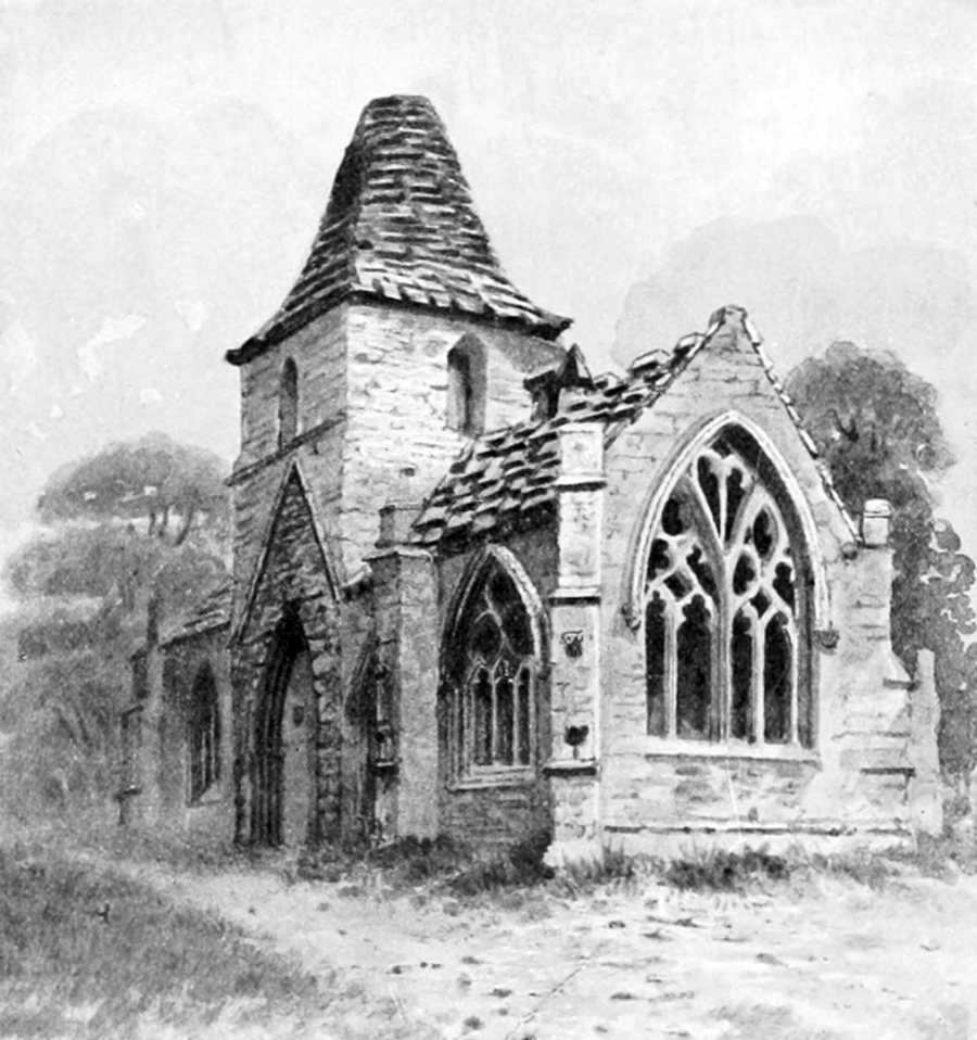
The origin of the image immediately above is not certain. It appears in the book Tranent and Its Surroundings, historic, ecclesiastical, 2nd edn, which was published in 1884 and written by Peter M’Neill. In the text it gives no details of the image.
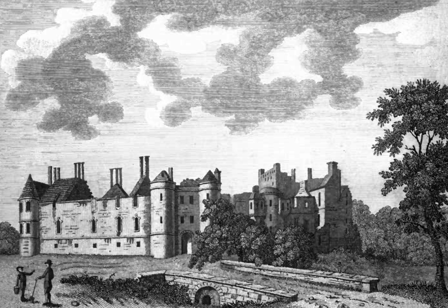
The two images directly beneath are from Antiquities of Scotland, volume 1, by Francis Grose, published in 1797. A note about Plate 1 states it is from 1789, but a note for Plate 2 states ‘This view shews the building in a much more perfect state, it having been drawn a great many years ago. There is a tradition, that King Charles the First was entertained here with all his retinue.’ The views are both from approx the same vantage point, but in Plate 1 the building is far more ruinous and the entrance block with flanking round towers has either been demolished or has collapsed.
The two images below that are by Sir John Clerk of Eldin, although there is no indication of the date, other than they are from the the mid to late 18th century.
The last four images have no attribution on Canmore.
Below the map at the foot of the page, the images have been grouped together from the same approx viewpoint to contrast and compare…
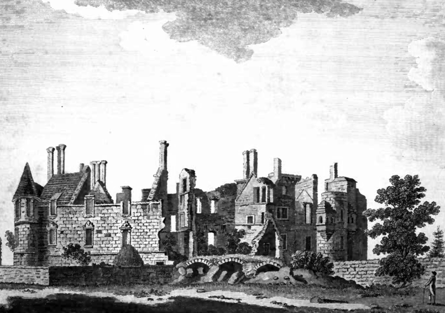 Seton Castle: ruin of Seton Palace (Plate 1, Grose, 1789)
 Seton Castle: Plate 2, ruins of Seton Palace, the building is not a ruinous (Grose, before 1789)
 Seton Palace by ?Sir John Clerk of Eldin (1727-1812), © RCAHMS, http://canmore.org.uk/collection/987293
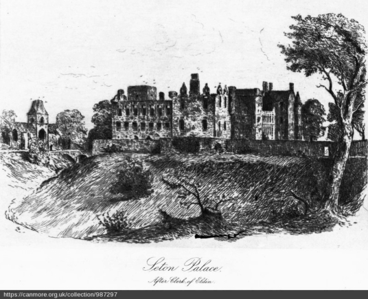 Seton Palace and Seton Chapel by Sir John Clerk of Eldin (1727-1812), © RCAHMS, http://canmore.org.uk/collection/987297
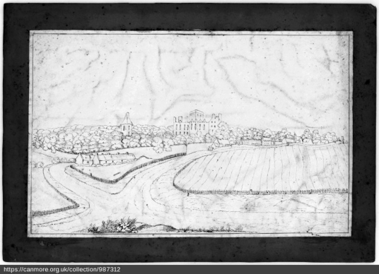
 Seton Palace from NW, © RCAHMS, http://canmore.org.uk/collection/987312
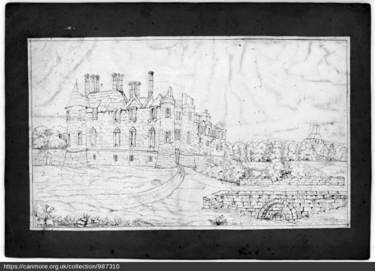
 Seton Palace from E, © RCAHMS, http://canmore.org.uk/collection/987310
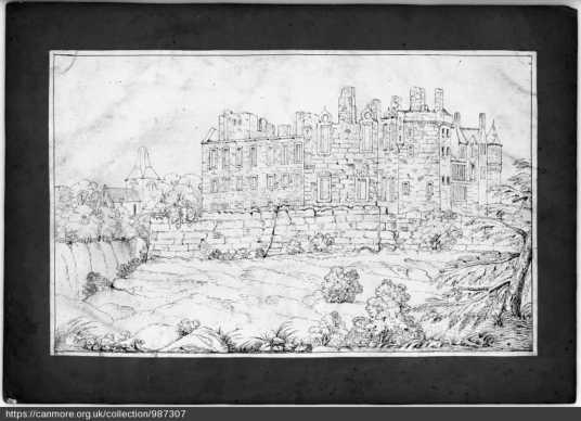 Seton Palace from N, © RCAHMS, http://canmore.org.uk/collection/987307
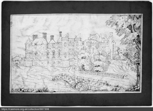 Seton Palace from S, © RCAHMS, http://canmore.org.uk/collection/987308
 Seton Castle: ruin of Seton Palace (Grose, 1789)
The lands were acquired by the Setons in the 12th century, and Christopher Seton was Robert the Bruce’s brother-in-law and supporter. He is believed to have saved Bruce’s life at the Battle of Methven in 1306, but was captured after the battle and then brutally executed by the English.
 Seton Castle: ruins of Seton Palace, presumably based on Grose (MacGibbon and Ross)
Sir Alexander Seton, perhaps his brother, was one of the Scottish nobles to add their seals to the Declaration of Arbroath in 1320. He was Governor of Berwick when the burgh surrendered in 1333 and his son was hanged by the English.
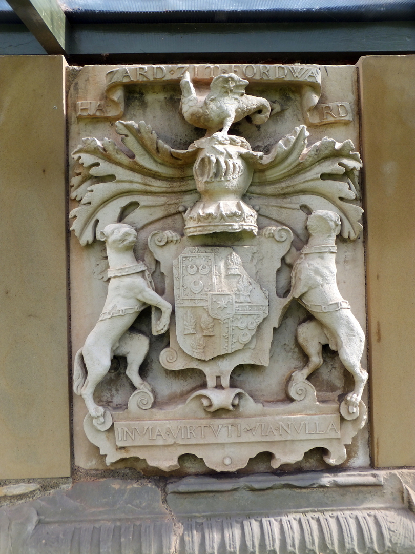 Seton Castle: coat of arms, Seton Collegiate Church (© Martin Coventry)
William Seton was made Lord Seton in 1371, and the Setons married into the Gordons and their descendants were the Earls of Huntly, although they retained the Gordon name. William Seton, Master of Seton, was slain at the bloody Battle of Verneuil in France in 1424 fighting the English during the 100 Years War. James IV visited Seton in 1498, and George, 3rd Lord Seton, was killed at the Battle of Flodden in 1513. James V also visited.
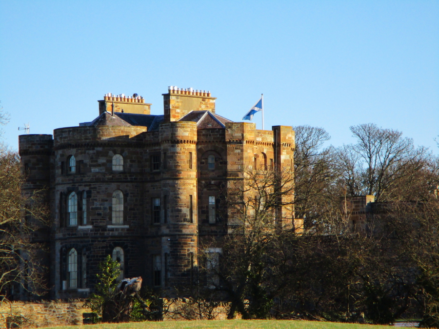 Seton Castle (© Martin Coventry)
 Seton Castle (old postcard)
 Seton Castle (© Martin Coventry)
An older castle was destroyed by the English in 1544, and a new house – the Palace – was built (or rebuilt anyway) on the site. George, 5th Lord Seton, was a friend and supporter of Mary, Queen of Scots, and she fled here after the murder of David Rizzio at the Palace of Holyroodhouse in 1566, as well as playing golf and practising archery here. She also visited with James Hepburn, Earl of Bothwell, after the assassination of Henry Stewart, Lord Darnley, her second husband.
 Seton Castle: ruin of Seton Palace (Grose, 1789)
The following year her army camped at the castle the night before defeat at Carberry Hill. The Setons helped to rescue Mary from imprisonment in Loch Leven Castle, after which she stayed at another of their properties, Niddry Castle. They fought for her at Langside, but were defeated and the 5th Lord escaped to Flanders, although he later returned and was one of the judges at the trial of James Douglas, Earl of Morton, for the murder of Darnley. Morton was beheaded.
 Seton Castle (© Martin Coventry)
Robert Seton, 8th Lord Seton, was made Earl of Winton in 1600, and Alexander Seton, son of George, 7th Lord Seton, was made Earl of Dunfermline six years later (also see Pinkie House, Dalgety, and Fyvie Castle). Robert Seton, 8th Lord Seton, had a ratification of 1592 granting the erection of the harbour at Cockenzie in a free harbour, and of the erection of the town of Cockenzie in a free burgh of barony. The family built a new harbour at Port Seton in the 17th century.
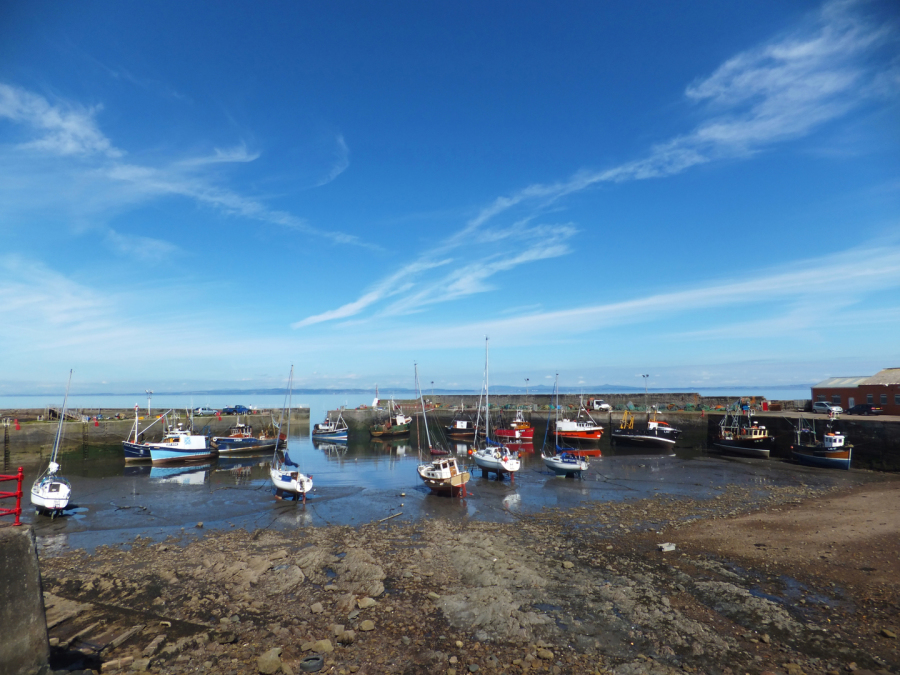 Seton Castle: Port Seton harbour (© Martin Coventry)
James VI visited Seton Palace in 1603, as later did Charles I and Charles II.
The house was damaged and burned out during the 1715 Jacobite Rising – having been held for three days by Highlanders against Hanoverian forces – after which George Seton, 5th Earl of Winton, and his family were forfeited.
 Seton Castle: Seton Palace, the origin of the image is not clear (M'Neill, 1884)
 Seton Castle (© Martin Coventry)
The property went to the York Building Company, which managed the estate and the coal woarking and saltpans, but the company went bust. The estate and castle were sold in the 1780s to Alexander Mackenzie (his father held the Portmore estate near Eddleston in the Borders), a young lawyer and a Lieutant Colonel of the 21st Dragoons, but after Mackenzie’s death in 1796 was soon (like so much of East Lothian) in the hands of the Earls of Wemyss,, who held it until 2003.
 Seton Castle (© Martin Coventry)
 Seton Palace: Seton Castle (old postcard)
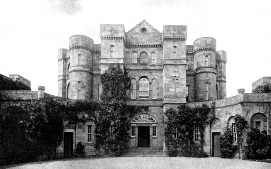
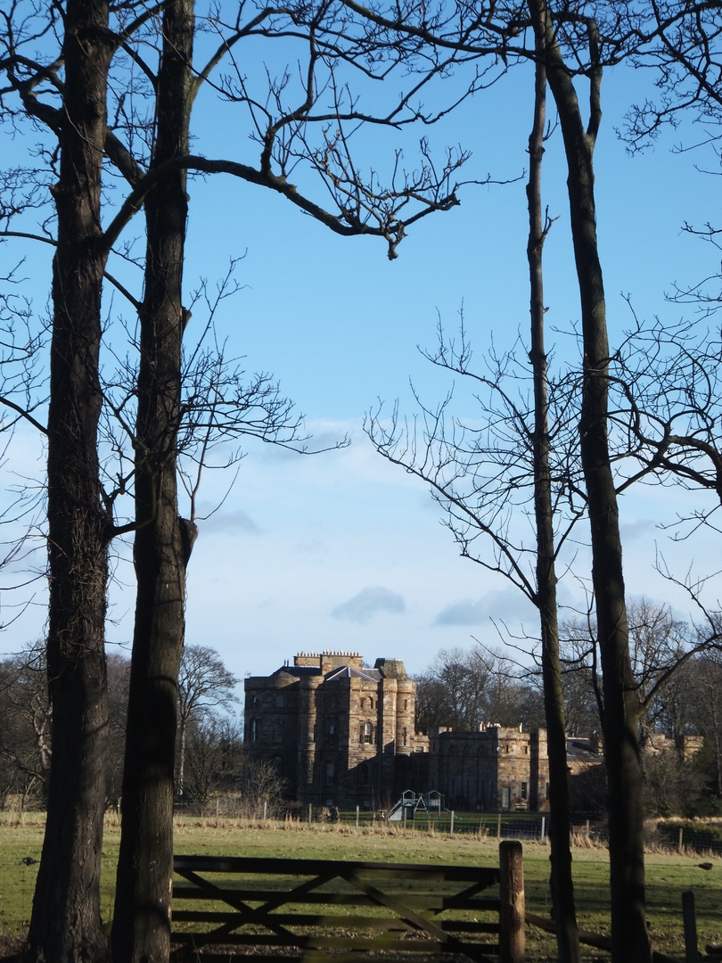
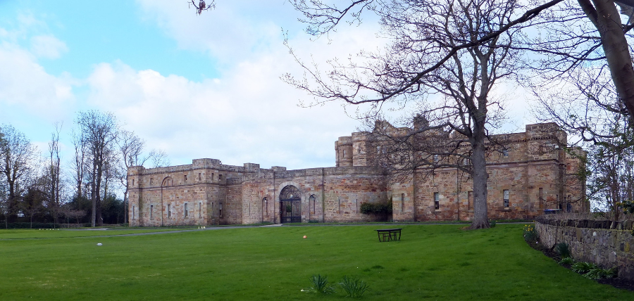
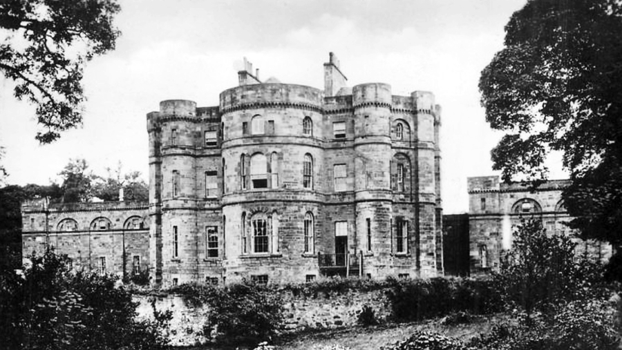
The house was left a ruin and was finally demolished in 1790, maybe slightly earier, except perhaps for some of the vaulted basement, and a new mansion, an imposing castellated edifice of four storeys and designed by Robert Adam, was built on the site. The house has a large outer walled courtyard and two extensive wings, and sits in 15 acres of grounds. The property was put up for sale in 2008 for £5 million, and then in 2019 for £8 million.
 Seton Castle: round tower at north-west (© Martin Coventry)
 Seton Castle: round tower at south-west (© Martin Coventry)
 Seton Castle: round tower at south-west (Seton, 1899)
 Seton Castle: gunloop in round tower at north-west (© Martin Coventry)
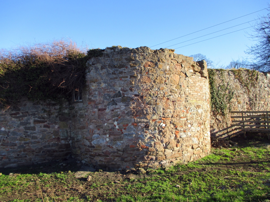
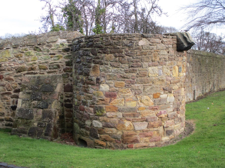
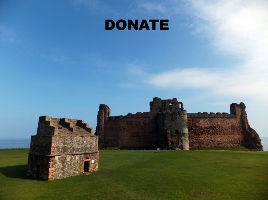
The walled enclosure survives and there are three round towers of the original four, one at the south-west corner with a gunloop. The tower at the north-west is the largest, and the tower at the north-east forms part of the wall around the collegiate church. The fourth tower, at the south-east, has gone.
 Seton Castle: round tower at north-east and Seton Collegiate Church (© Martin Coventry)
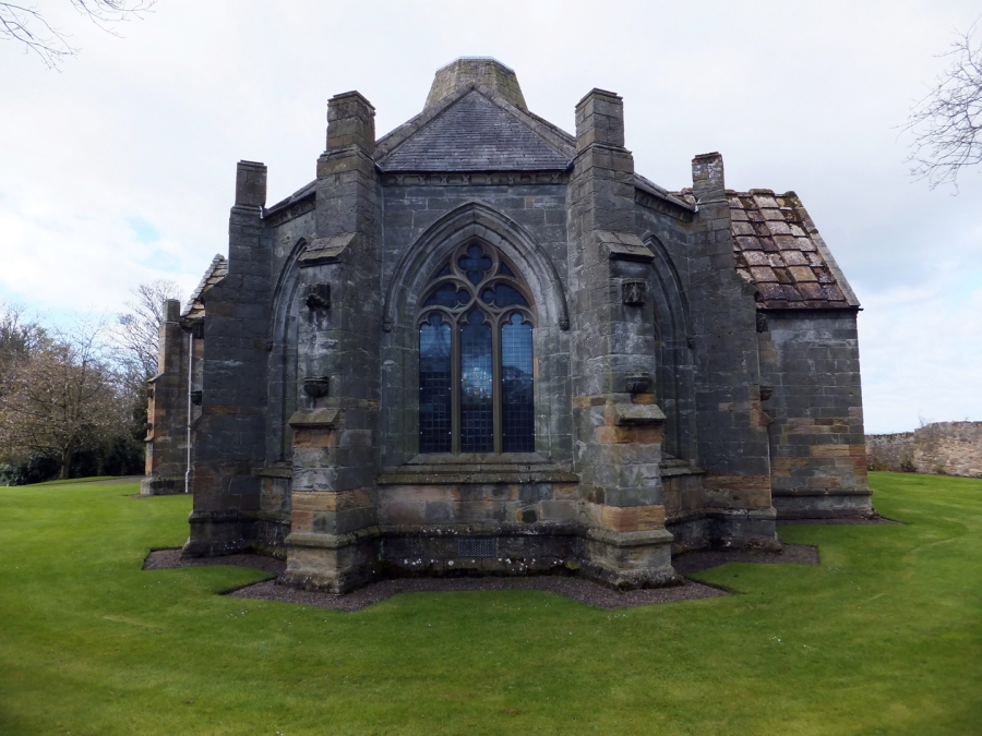
 Seton Castle: Seton Collegiate Church (© Martin Coventry)
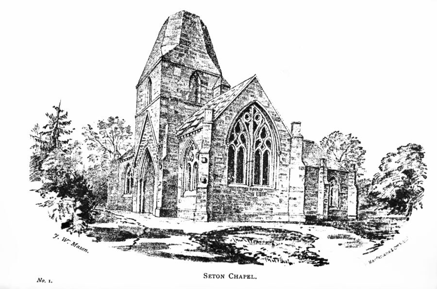
 Seton Palace: Seton Collegiate Church (Seton, 1899)
 Seton Castle: Seton Collegiate Church (© Martin Coventry)
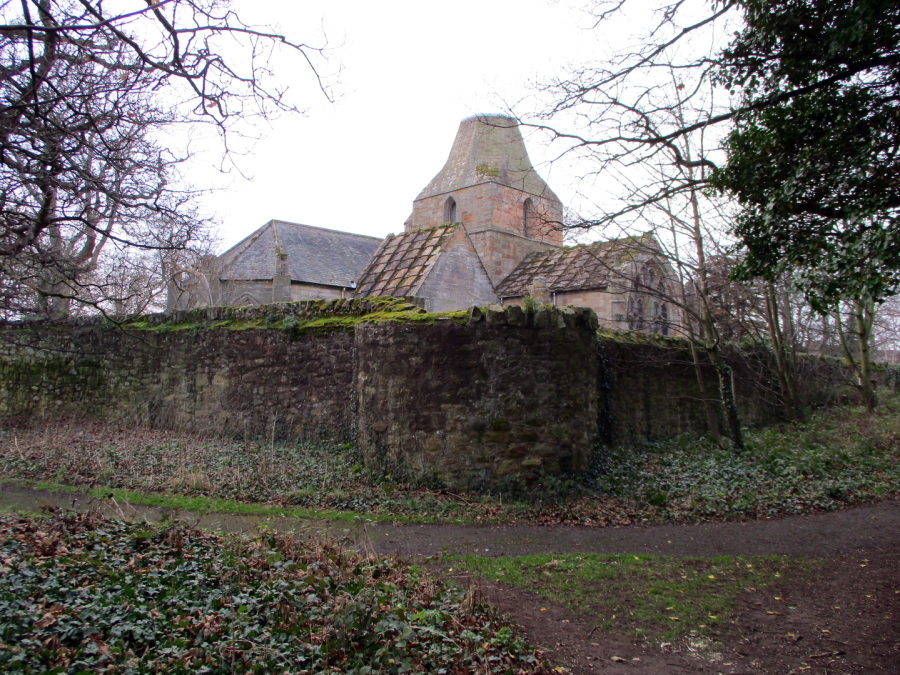
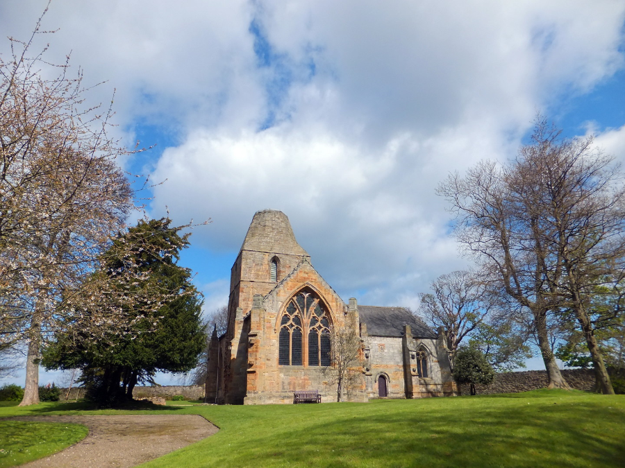
A fine collegiate church [NT 418751] stands near the house in an atmospheric and peaceful wooded location. The college (a religious community of six priests) was founded in 1492 by George, 4th Lord Seton, and the church contains a stone effigy of a knight and his wife, a memorial to the 5th Lord Seton, another George, and other monuments. The roof is vaulted, and transepts were added in the 16th century, as was a square, rib-vaulted tower.
 Seton Palace: Seton Collegiate Church (Smith, 1898)
 Seton Castle: Seton Collegiare Church, interior (© Martin Coventry)
The church was looted and burned by the English in 1544,and was ransacked after the 1715 Jacobite Rising. After the property had passed to the Earls of Wemyss, the church was restored and then used as their burial place.
There are also remains of the domestic buildings of the college, although these were remodelled for later use.
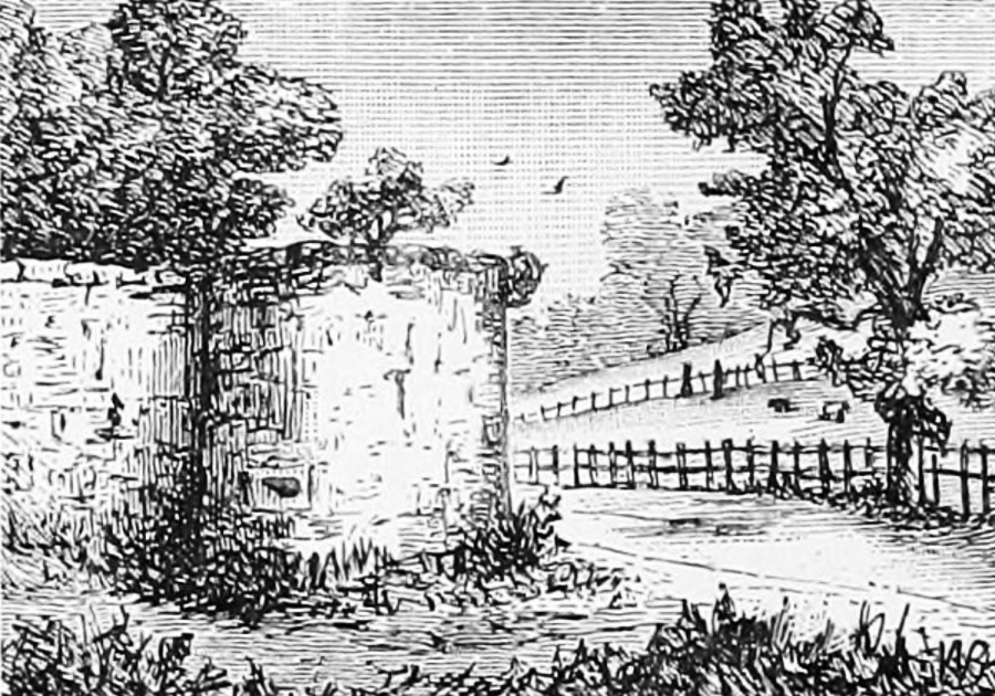
 Seton Castle: Seton Collegiate Church (M'Neill, 1884)
 Seton Castle: Seton Collegiate Church, entrance (© Martin Coventry)
There was a village of Seton [NT 416750?] or Seaton, located approx between the present day farm and cottages at Seton (or what is also now known as East Seton) and Seton Castle, and this was made a free burgh for Sir Alexander Seton by Robert the Bruce in 1321.
 Seton Castle: site of Seton village (© Martin Coventry)
 Seton Palace: Seton Castle (Seton, 1899)
The place is marked on Adair's map of East Lothian, and is depicted on both sides of a stream (which was also the lade for the mill) with backlands and a large pond, then on General Roy's map* of the 1740s and 50s, in more detail although the layout appears to be much the same. The village survived until the 1790s when it had a population of 86, mostly masons, weavers, tailors and shoemakers, but around then was mostly cleared by Alexander Mackenzie, the then owner of the Seton estate, the story going that many of the inhabitants had no deeds to their properties. Mackenzie is said to have been cursed by one of those he cleared, and he died unmarried in 1796 at the age of 27 in the West Indies, and the property was sold to the Earl of Wemyss. The farmhouse at (East) Seton dates from about 1800. *If you drag the map Roy will appear, the overlay does not match Roy's map…
 Seton Castle: Seton Collegiate Church (© Martin Coventry)
There are no apparent remains of the village, and the pond has also gone, not being marked on Forrest's map published 1802.
Two mills are marked on Adair's and later maps, one of which Seton Mill [NT 417752] survives, with kiln, granary, barn and cottage, dating from the 18th century or earlier, but this has been converted for residential use. Mary Slessor (and black children that she had converted) ‘dwelt here for a period’. There was also a mill at the village of Seton, and a round doocot is also marked on a map, near the former village.
 Seton Castle: Seton Mill, private (© Martin Coventry)
The lade survives within the grounds of Seton Castle, but the stream, which ran from Meadowmill, now appears to be either subterranean, or has been diverted (perhaps due to the former open cast mine at Riggonhead / Blindwells or road realignments) until it reaches Seton Castle, where it flows through a defile. The stream is still marked on OS maps from the 1920s but not on later maps. The bridge for the burn survives, crossed by Fisher(gate) Road, the route down to Port Seton. There was also a seamill.
Views of Seton Palace, please note the images are copyright of the holders…
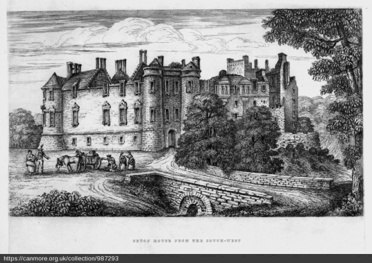
From the south west…
 Seton Castle: Seton Palace, the origin of the image is not clear (M'Neill, 1884)
From the south (west)…
 Seton Palace and the Forth Estuary (1639?) by Alexander Keirincx (1600-1652), Photographer: Antonia Reeve, source: National Gallery of Scotland
From the south…
 Seton Palace from E, © RCAHMS, http://canmore.org.uk/collection/987310
From the south east…
 Seton Palace from S, © RCAHMS, http://canmore.org.uk/collection/987308
 Seton Palace by ?Sir John Clerk of Eldin (1727-1812), © RCAHMS, http://canmore.org.uk/collection/987293
 Seton Castle: Plate 2, ruins of Seton Palace (Grose, before 1789)
 Seton Castle: ruin of Seton Palace (Plate 1, Grose, 1789)
From the north…
 Seton Palace from N, © RCAHMS, http://canmore.org.uk/collection/987307
 Seton Palace and Seton Chapel by Sir John Clerk of Eldin (1727-1812), © RCAHMS, http://canmore.org.uk/collection/987297
From the north west…
 Seton Palace from NW, © RCAHMS, http://canmore.org.uk/collection/987312
 The Castles of Scotland New Sixth Edition by Martin Coventry
New sixth edition.
The book is now available.
 Viridian: a vivid blend of book and website

Check any and all opening and access information with the sites themselves…


Contact Us


Goblinshead
Cockenzie House
22 Edinburgh Road
Cockenzie
EH32 0HY
Email: info@thecastlesofscotland.co.uk
Or use our contact form.