Old Castle Pictures, Photos, Engravings, Paintings and Drawings (listed alphabetically)
A selection of old images of castles, towers stately homes and historic houses, where there is no page elsewhere on the website for the place. Some of these buildings have been demolished, others have been restored, some are exactly the same as pictured.
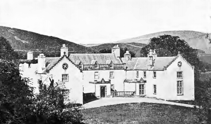
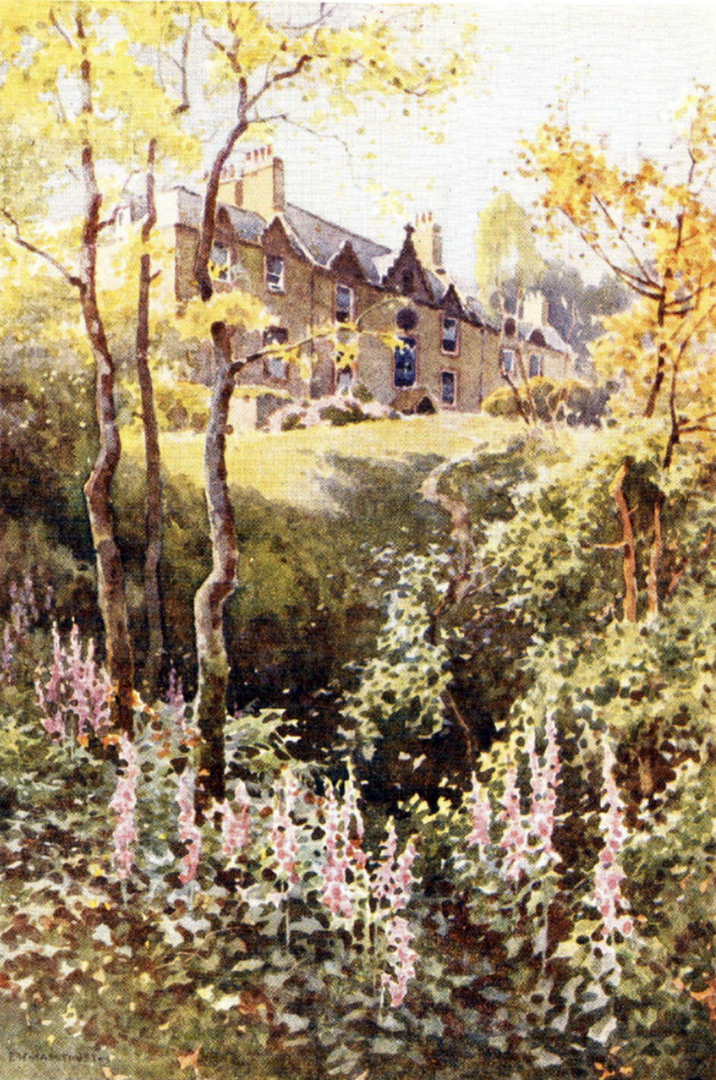
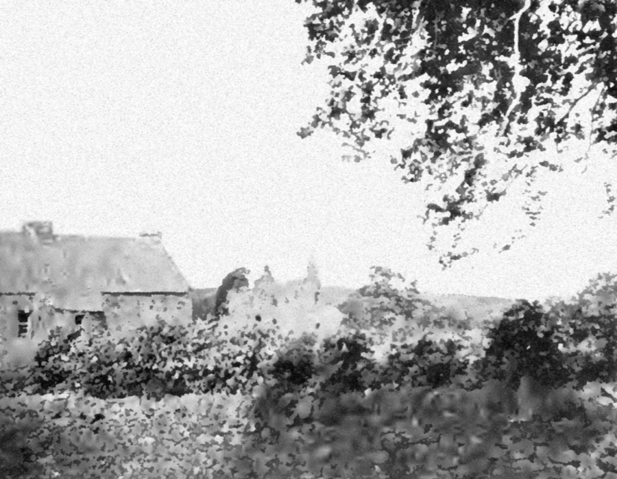
Ashiesteel
Borders: About 3 miles west of Galashiels, on minor road south from A72 1.5 miles south-west of Colvenfords, south of the River Tweed, at Ashiesteel.
Private NT 430351 OS: 73 TD1 3LJ
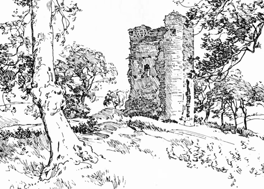
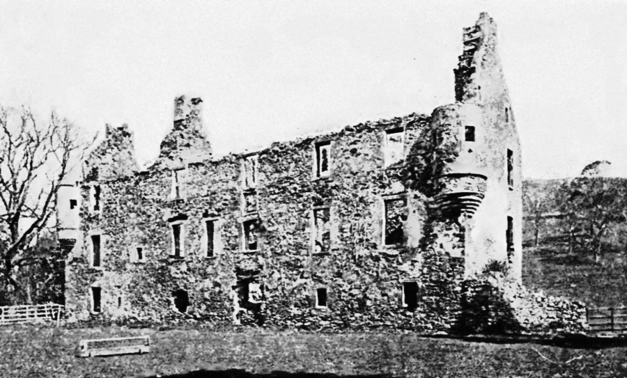
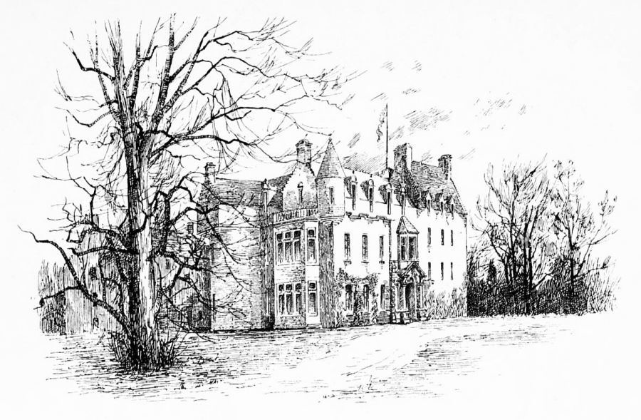
 Ashiesteel (Pringle, 1914)
 Ashiesteel (Haslehurst, 1922)
This was a property of the Russells of Ashiesteel, one of whom was Major General Sir James Russell. Ashiesteel was home to Sir Walter Scott from 1804-12, and it was here that he wrote ‘The Lay of the Last Minstrel’, ‘The Lady of the Lake’, ‘Marmion’, and part of the Waverley novels.
Barskimming
Ayrshire: About 1.5 miles south-west of Mauchline, on minor roads south of B743, south of River Ayr, at or near Old Barskimming.
Ruin or site NS 482251 OS: 70 KA5 5HD
 Barskimming (1788)
Site of castle or old house at or near Old Barskimming. Barskimming is a plain classical mansion, dating from 1883, and built when the old house of about
1770 was burned down in 1882. Some of the older fabric was incorporated and there were later alterations. There is a pediment with the date 1642, and a walled garden.
‘Barskymming’ is shown on Blaeu’s map of Kyle as a tower in an enclosed and wooded park.
The lands were held by the Whites at the beginning of the 14th century, then by the Reids from 1375, John Reid of Barskimming on record in 1479, and
they held them until 1615. Barskimming was sold to the Stewarts, then to the Richard family and Gilbert Richard of Barskimming is mentioned in a commission for the burning of the gates of Drumlanrig.
In 1691 Barskimming passed to the Millers, and they were made baronets in 1778. Sir William Miller was Lord President of the Court of Session. The property was sold to the Galbraiths in the 20th
century.
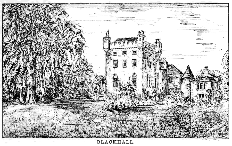
Blackhall, Banchory
Kincardine & Deeside: About 2 miles west of Banchory, on minor roads west of B974, south of River Dee, at or near Blackhall.
Ruin or site NO 670961 OS: 45 AB31 4AN
 Blackhall, Banchory (Wimberley, 1894)
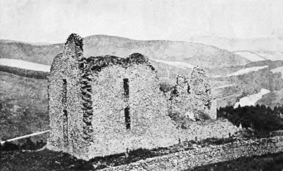
Brochel Castle, Raasay
South Highland: On north-east side of island of Raasay, 6.5 miles north and east of Clachan, on minor road, at Brochel.
Ruin or site NG 585463 OS: 24 IV40 8PB
 Brochel Castle, Ramsay: far more complete than today (Daniell, 1822)
Perched on a high rock in a spectacular location, Brochel Castle is a small ruined fortress, built early in the 16th century. Stumps of walls surround an uneven courtyard, contouring the rock,
with several towers. It was entered by a steep stair, leading to a passageway through the gatehouse.
‘Breokdill’ is marked on Blaeu’s map of Skye and Raasay.
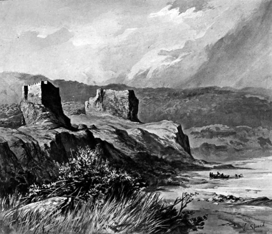 Brochel Castle, Raasay (Hill, 1890)
This was a property of the MacLeods of Raasay. The last chief resident at Brochel was probably Iain Garbh around 1648, after which the family moved to Clachan, at Kilmaluag, further south on
Raasay, although this later tower house has gone.
The ruin is in a dangerous condition.
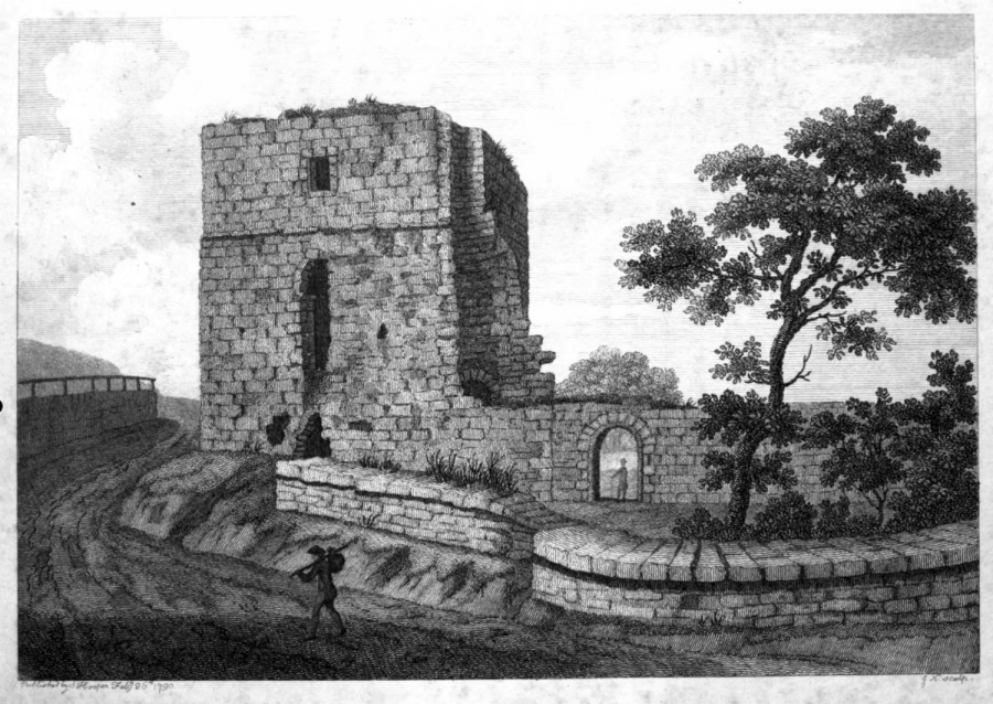
Buittle Place
Galloway: About 1 mile west of Dalbeattie, on minor road north of A745, short distance west of the Water of Urr, near 13th-century Buittle Castle. Buittle Place.
Private NX 817616 OS: 84 DG7 1PA
 Brittle (Grose, 1790)
Buittle Place is a plain late 16th-century L-plan tower house, probably largely built from masonry from the nearby 13th-century castle. The roof has been lowered, and nothing remains of bartizans
but corbelling. A narrow round stair-turret rises in the re-entrant angle.
The original entrance, in the wing, led to a stair, which has been removed, up to the hall on the first floor, and to the basement of the wing. The vaulted basement, of the main block, is
reached by a modern doorway. The house has been extensively altered, and is a plain edifice with whitewashed walls. The first floor is now reached by an external stairway.
‘Butill’ is marked on Blaeu’s map of Kirkcudbright, although not with any prominence.
From the 13th century the lands of Buittle were held by the Balliol family, who were based at nearby Buittle Castle. The property passed to the Douglas family, then to the Johnstones after
1455, and in the 16th century to the Maxwells, then by marriage to the Gordons of Lochinvar, who built the tower. James Gordon of Buittle is on record in 1649. Later that century, the lands went to
the Maxwells, and they held them into the 19th century or later.
In 1790 the tower was a roofless and overgrown ruin, but it has been restored and is now occupied.
Buittle Old Church [NX 808598] dates from the 13th century but is ruinous, and in the churchyard are many old memorials, including from the 17th century.
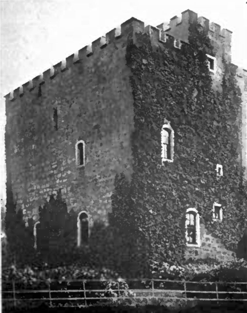
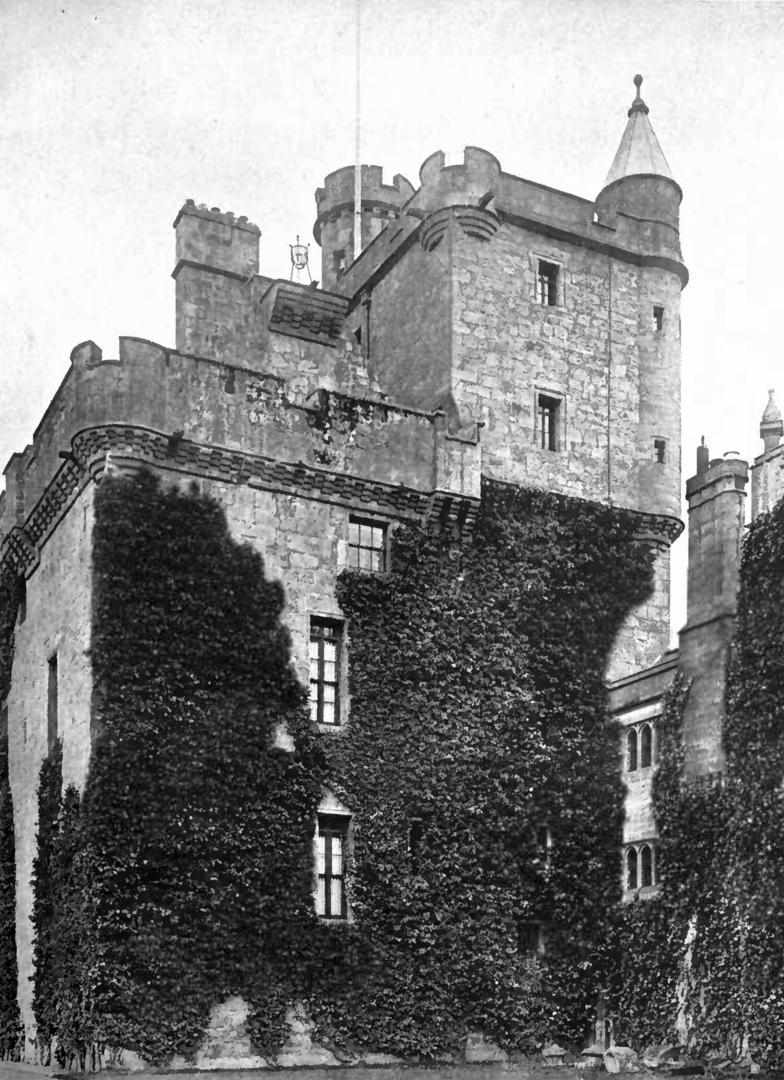
Closeburn Castle
Dumfriesshire: About 3 miles south-east of Thornhill, on minor road east of A76, about 1 mile east of Closeburn village, south of Closeburn Mains, at Closeburn Castle.
Private NX 907921 OS: 78 DG3 5HJ
 Closeburn Castle (RCAHMCS, 1920)
One of the oldest continuously inhabited houses in Scotland, Closeburn Castle is a massive rectangular 14th-century tower of four storeys, with a flush crenellated parapet, to which has been added
a 19th-century mansion. The tower still has an iron yett. A courtyard has had round towers at the corners, and formerly had a moat. There is a walled garden.
The basement is vaulted, as is the hall and the top storey, and has a prison. The hall has been subdivided. A turnpike stair leads to the upper floors in the thickness of one wall. The
interior has been altered.
‘Closburne’ is prominently marked on Blaeu’s map of Nithsdale.
 Closeburn Castle (Grose, 1789)
The lands were granted to the Kirkpatricks in 1232, who built the castle. Roger Kirkpatrick, along with Lindsay of Dunrod, joined Robert the Bruce in stabbing John Comyn to death in a church in
Dumfries in 1306. Sir Roger Kirkpatrick of Closeburn captured the castles of Dalswinton and Caerlaverock from the English in 1355. He was murdered by Sir James Lindsay in 1357 during a quarrel at
Caerlaverock. Thomas Kirkpatrick of Closeburn had a ratification of 1672 which mentions the tower, fortalice and manor place of Closeburn. The family were made baronets of Nova Scotia in 1685. The
Empress Eugenie, wife of Napoleon III, was descended from the family, and many of the Kirkpatricks are buried at Garvald [NY 041903], where there are the remains of the church dating from or
remodelled in 1617.
The house was damaged by fire in 1748, and was sold in 1783 to a Reverend James Stewart-Menteith. The family were made baronets in 1838, but the property passed in 1852 to the Bairds. It is
still occupied. The line of the Kirkpatricks, baronets, continues, although they now live in Australia, while the Stuart-Menteiths, baronets, live near Castle Douglas in Dumfries and Galloway.
The Kirkpatrick family have a mausoleum and burial enclosure at the old church at Closeburn [NX 904923]
A red-breasted swan was said to appear here as a portent of a death in the Kirkpatrick (or resident) family.
Cockburnspath Castle
 Cockburnspath Tower (Collins, 1912)
 Cockburnspath Tower (Hannah, 1913)
 Cockeburnspath Castle (Grose, 1790)
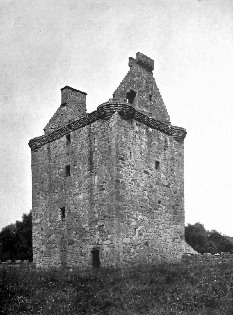
Corsbie Tower
 Corsbie Tower (Collins, 1912)
Craig, Aberdeenshire
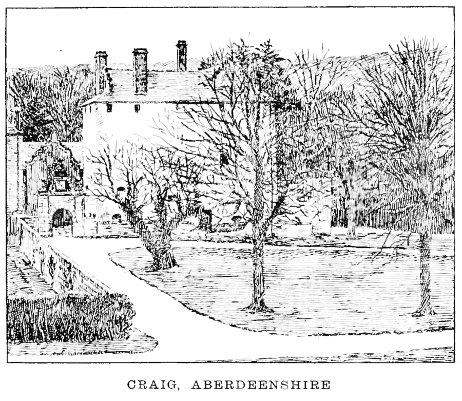 Craig, Aberdeenshire (Wimberley, 1894)
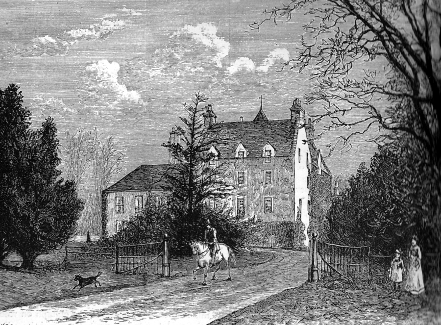
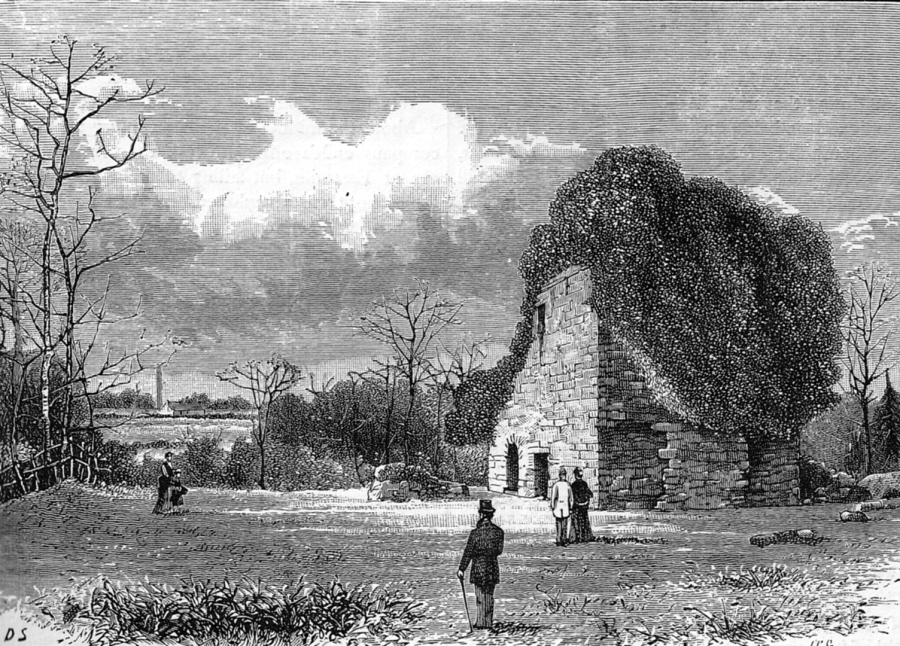
Drum House / The Drum, Edinburgh
Lothians: About 4.5 miles south-east of Edinburgh Castle, on minor roads west of A772 or east of A7, east of Gilmerton, at Drum House or The Drum
.
Private NT 301688 OS: 66 EH17 8RX
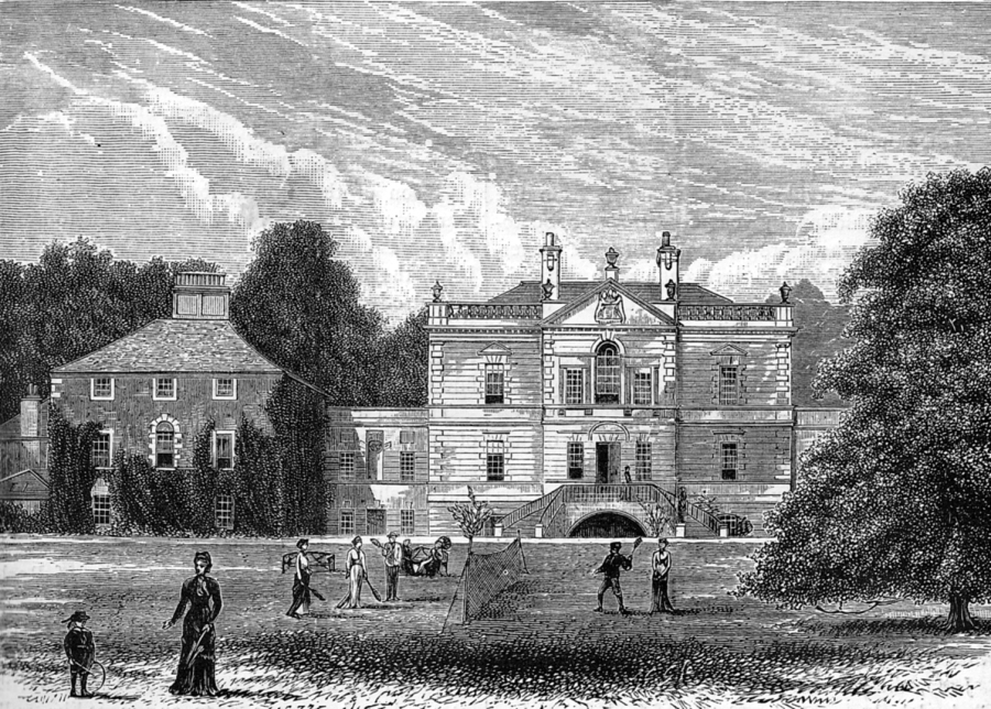 Drum House or The Drum, Edinburgh (Grant, OANE, c.1880s)
Little remains of a substantial 16th-century tower house, which was replaced by a symmetrical classical mansion of 1726-34, designed by William Adam. Part
of the tower is built into the single flanking pavilion (the other was not built). The mansion has some fine plasterwork.
The place does not appear to be marked on Blaeu, but is marked on Adair’s map of Midlothian.
 Drum House or The Drum, Edinburgh (MacGibbon and Ross)
Drum was held by the Herring family, but passed by marriage to the Somervilles of Linton. Sir John Somerville of the Drum was killed at the Battle of
Flodden in 1513, while James, 6th Lord, was badly wounded at the Battle of Langside in 1568, fighting for Mary. The lands of Drum and Gilmerton, with the tower, fortalice, manor place are mentioned
in a ratification of 1645. James Somerville of Drum was killed by Thomas Learmonth in 1682 after a duel, although the duel was not with him. The Somervilles built the present mansion.
Drum later passed to the Nisbets of Cairnhill, and is owned by the More Nisbetts of The Drum and Cairnhill.
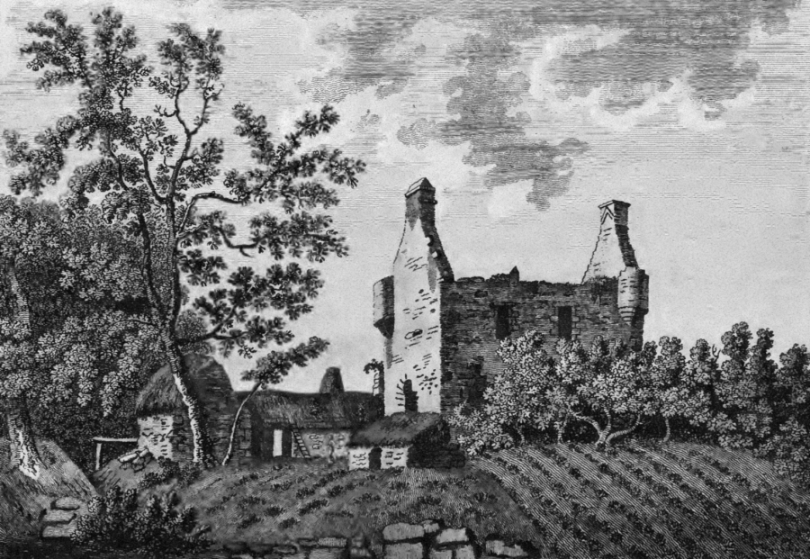
Edmonstone
Lothians: About 4 miles south-east of Edinburgh Castle, on minor roads between A6106, The Wisp, and A7, west of Danderhall, at Edmonstone.
Private NT 299699 OS: 66 EH16 4SJ
 Edmonstone House: demolished (Grant, OANE, c.1880s)
Site of castle, said to have been surrounded by a moat, on which Edmonstone House was built (or rebuilt). The mansion, a classical edifice, was remodelled after a fire in about 1800, then again in the 1830s by William Burn. The building was demolished in the 1950s, and nothing remains but foundations, except for the gatepiers of the house, ruins of the stables and landscape features. There are plans to redevelop the estate with the building of many houses, but it is not clear how far these have got.
‘Edmondstoun’ is marked on Blaeu’s map of The Lothians in a fenced park, then on Adair’s map of Midlothian, again in enclosed and wooded policies.
This was a property of the Edmonstones from 1248, who were said to have come to Scotland with Queen Margaret, wife of Malcolm Canmore, until the 17th century.
Edmonstone was sold to the Rait or Raith family in 1630, then went by marriage in 1671 to the Wauchopes of Niddrie, later Don Wauchope, when the heiress Anne Rait married Sir John Wauchope,
son of Sir John Wauchope of Niddrie Marischal. Sir John Wauchope, Lord Edmonstone, was a Lord of Session.
The family had a burial vault [NT 305699] at the old church of Woolmet.
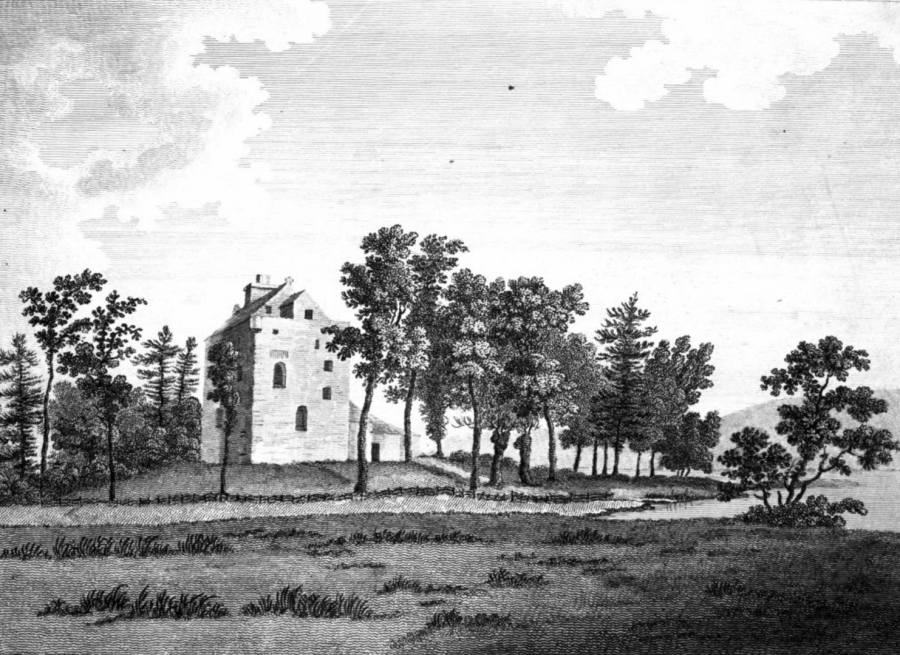
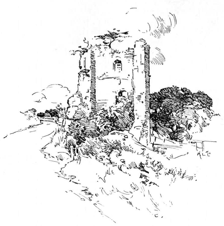
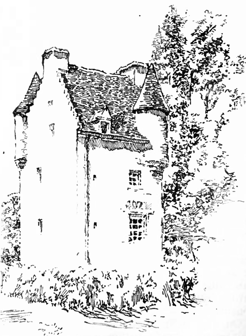
Elibank Tower
 Elibank Tower (Pringle, 1914)
Elshieshields Tower
 Elshieshields Tower (RCAHMCS, 1920)
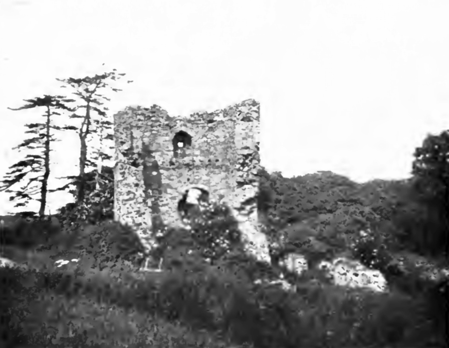
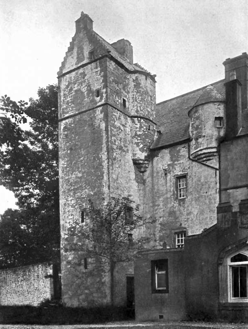
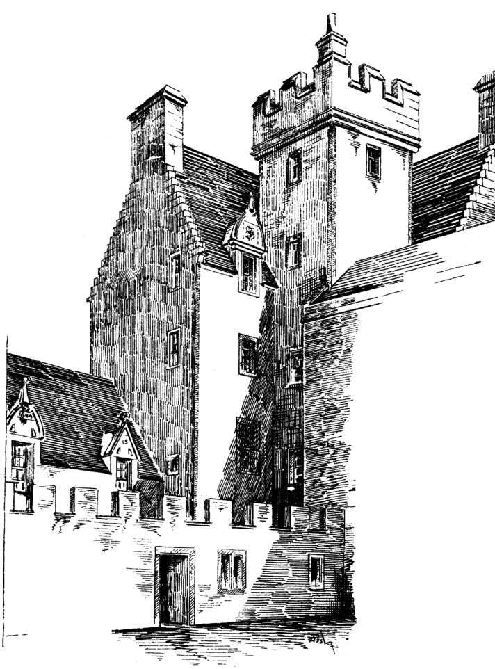
Fairnilee House
 Fairnilee House (Pringle, 1914)
Fast Castle
 Fast Castle (Scotland Illustrated, 1838)
 Fast Castle (Collins, 1912)
Foumerkland Tower
 Foumerkland Tower (RCAHMCS, 1920)
Garleton Castle
 Garleton Castle (Hannah, 1913)
Granton Castle
 Granton Castle (Hannah, 1913)
Hoddam Castle
 Hoddam Castle (RCAHMCS, 1920)
Hollows Tower (Gilnockie)
 Hollows Tower, Gilnockie: since reroofed (RCAHMCS, 1920)
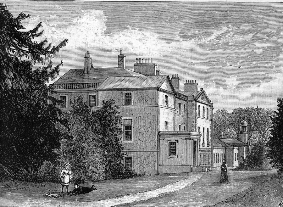
Inch House / The Inch
Lothians: About 2.5 miles south-east of Edinburgh Castle, on minor roads west of A772, west of A7, just south of Cameron Toll, Gilmerton Road, at The Inch.
Private NT 278709 OS: 66 EH16 5UF
OPEN: Community centre. Tel: 0131 664 4710
 Inch House or The Inch (Grant, OANE, 1880s?)
 Inch House or The Inch (MacGibbon and Ross)
Inch House, or The Inch, consists of a 17th-century L-plan tower house of four storeys and a garret, and incorporates earlier work. A lower extension was added in 1634, another was added in the
18th century, and the house was remodelled in 1891.
There is a large lectern-style doocot [NT 273706], possibly the largest in the Edinburgh area with 2072 roosting holes, and dating from the 16th or 17th century.
The original entrance was in the square stair-tower in the re-entrant angle. The inside of the tower has been altered, but two vaulted basement chambers survive.
‘Nether Libertoun’ is marked on Blaeu’s map of The Lothians.
The lands were originally a property of Holyrood Abbey, but passed in about 1600 to the Gilmours. Lochend House was burned by William Gilmour of the Inch about 1601, although the Winram family
soon held the property. James Winram of Nether Liberton was Keeper of the Great Seal in 1623. George Winram of Liberton was mortally wounded at Dunbar in 1650 and died soon after the battle.
The property returned to the Gilmours of Craigmillar in 1660, later Little Gilmours and then Gordon Gilmours. The house was abandoned as a residence in the 1930s, and the property was
sold to the City of Edinburgh in 1946. It is now a community centre, and is surrounded by a public park.
 Inch House or The Inch (Speedy, 1892)
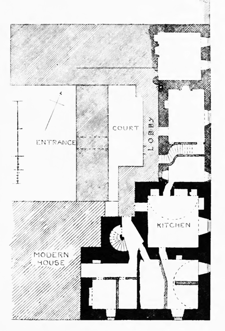 Inch House or The Inch: plan (MacGibbon and Ross)
Inverugie Castle
 Inverugie Castle (Wimberley, 1894)
Isle Tower
 Isle Tower (RCAHMCS, 1920)
Lennox Castle
Lothians: About 0.5 miles north-east of Balerno, from the A70 on the south bank above the Water of Leith, just south of Currie, at Lennox Castle.
Ruin or site NT 174671 OS: 65 EH14 6AJ
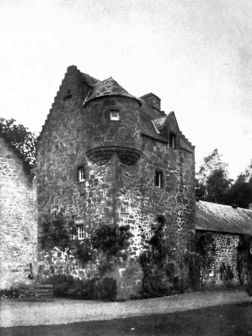
 Lennox Tower (Lymphoy), near Balerno, Edinburgh (Grant, OANE, c.1880s)
On high ground on a promontory above the Water of Leith, Lennox Castle is a ruinous but massive 15th-century tower, rectangular in plan, of which only the
basement remains. The walls are as much as 7 foot thick, the basement was divided into three vaulted cellars, and the hall above was also vaulted. The base of a turnpike stair survives close to the
entrance. There is a ditch protecting the site on the ‘landward’ side.
Lymphoy House [NT 174670] is a rambling house, dating from around 1835. It may have replaced an older house on the site.
‘Lumphoy’ is marked on Blaeu’s map of The Lothians.
This was a property of the Stewart Earls of Lennox, and was visited for hunting by Mary, Queen of Scots, the Regent Morton, and James VI. The property
was held by the Heriots of Lymphoy from the 16th century, one of whom Agnes Heriot of Lymphoy died in 1593 at Colinton Castle, having married into the Foulises of Colinton. One of the family was
George Heriot, known as ‘Jinglin Geordie’, who was a goldsmith in the time of Queen Anne, and bequeathed his large fortune to found George Heriot’s School.
One story is that the place is haunted by a ‘White Lady’, the apparition of a lady who died with her child in snowy weather, after being thrown out of
the tower by her slain husband’s family.
The castle reputedly had a tunnel to another building on the opposite bank of the river and to Lymphoy House – or even to Colinton Castle. The entrance
was reputedly found and a piper sent down it to explore it and, although his pipes were heard for some time. and still at times, he never returned.
Lincluden
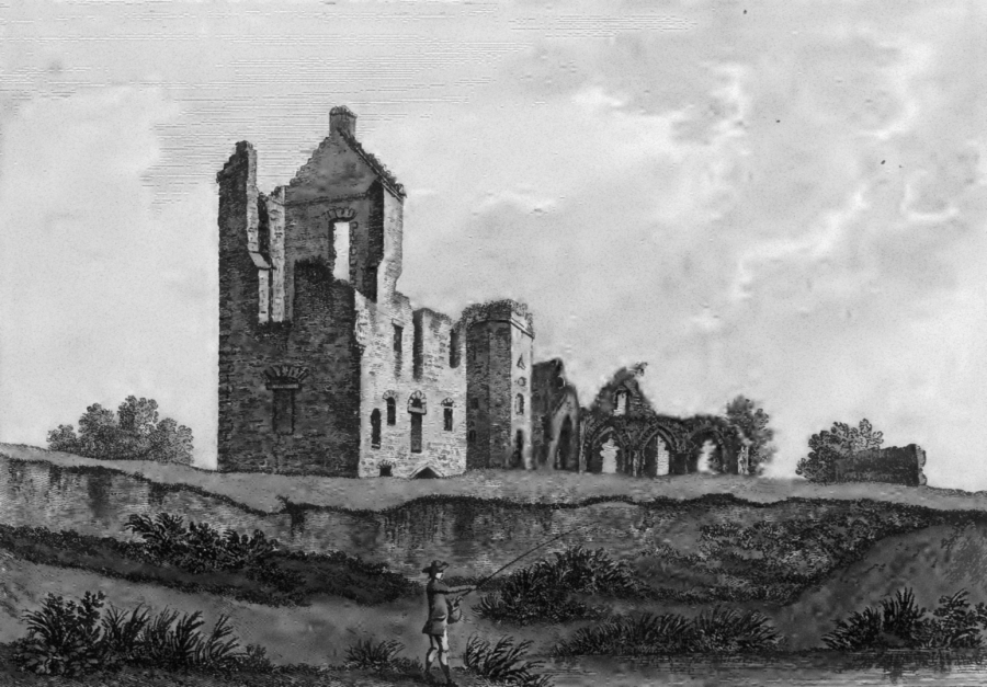 Lincluden (Grose, 1791)
Lochhouse Castle
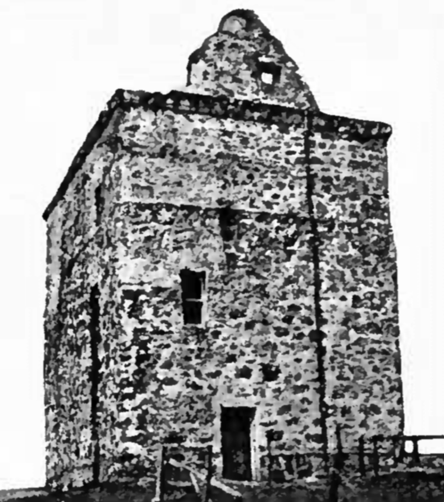 Lochhouse Castle (RCAHMCS, 1920)
Repentance Tower
 Repentance Tower (RCAHMCS, 1920)
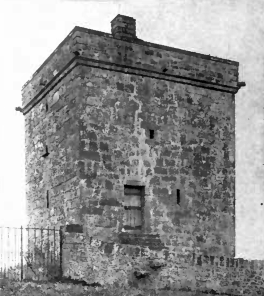
Stapleton Tower
 Stapleton Tower (RCAHMCS, 1920)
Stoneypath Tower
 Stoneypath Tower (Collins, 1912)
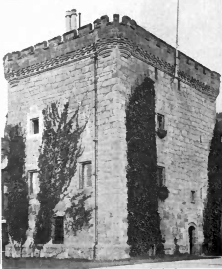
Terpersie Castle
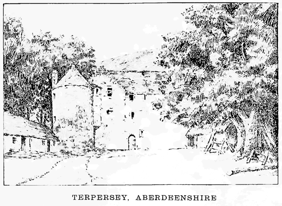 Terpersie Castle (Wimberley, 1894)
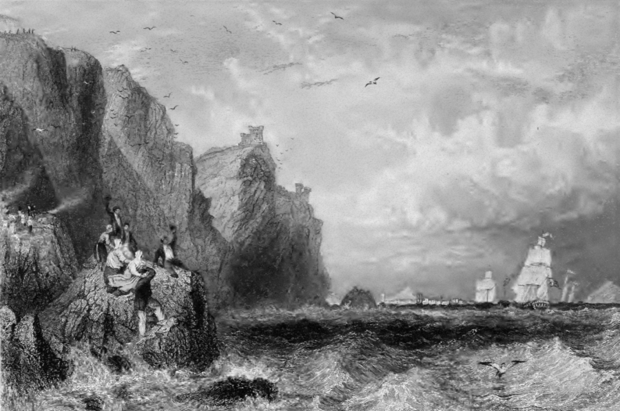
Thurso Castle (Castle Sinclair)
 Thurso Castle or Castle Sinclair (Daniell, 1822)
Torthorwold Castle
 Torthorwold Castle (RCAHMCS, 1920)
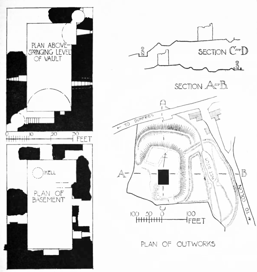 Torthorwold Castle: plan (RCAHMCS, 1920)
 The Castles of Scotland New Sixth Edition by Martin Coventry
New sixth edition.
The book is now available.
 Viridian: a vivid blend of book and website

Check any and all opening and access information with the sites themselves…


Contact Us


Goblinshead
Cockenzie House
22 Edinburgh Road
Cockenzie
EH32 0HY
Email: info@thecastlesofscotland.co.uk
Or use our contact form.